 Tuesday 7/25: We've been camping at Lake Tahoe, just a short distance from Minden, NV, so I made arrangements with Soar Minden. Weather has been great for soaring: hot and lots of moisture to form CU. I got checked out in Grob 103 (different model from my club's) by instructor 1. I'd been having stomach problems all morning and was feeling kind of shaky and "off". We took a 2000' tow. My takeoff wasn't the best - strayed off to the left before recovering. The tug looked to be a Pawnee, took us up at about 600 fpm. This ship has a turn&bank indicator, the first I've seen. (I didn't really use it, but every time I looked it was centered. It reacts much slower than the yaw string.) The radio has a speaker, so no need for a headset, but it's hard to hear. There's a temporary tower due to fire ops, and this is my first experience with ATC. (Fortunately the controllers are nice - one of them is taking glider training!) Long asphalt runway for landing - I have not landed on asphalt very much. One of my O2 connectors fit, thanks to my quick-connect setup, so I'll be able to use my own cannula and hose! The instructor commented that I lean to the left when flying - others have noticed that too, so I work on it when I remember. It's only 11:00 but there's slight thermal activity.
Their pattern starts at 1300 agl over IP - quite high, so lots of airbrake on the base and final. My airspeed was just a little high at 60 kt on final. Flared high. Touchdown good. Instructor took over to taxi to staging area. He signed off after one flight.
I broke for lunch, got set to fly solo at about 13:30. But my stomach issues were not over, so I cancelled my flight and decided to come back another day. The owner isn't satisfied, says the checkout was not thorough enough, should have included a rope break or something else. When I come back I need to work with an instructor again. That's a bummer... can't just show up and fly some afternoon. And this is going to get expensive. But... they're his aircraft, not mine. And he's fair about the costs, only charging for fractions of hours where appropriate.
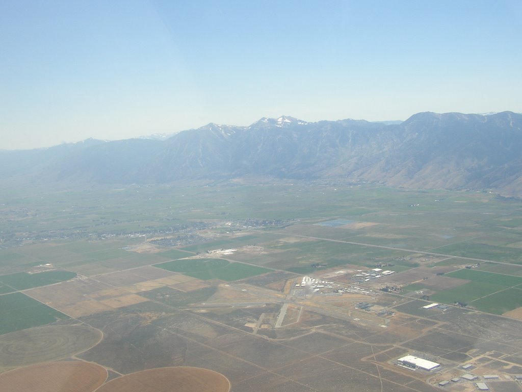
Area notes: cold air from Tahoe spills over mountains / down canyons, causing heavy sink below ridge. Pine Nut mtns not steep enough for true ridge soaring. Possible to thermal up high enough to get above mtns and see Tahoe. Forecast is 1100+
Thursday 7/29: checked out again with instructor 2. Solid takeoff this time. 17 min flight, some thermaling. More thorough ground tour of runways, taxiways etc. 2 is thoroughly happy with my flight, especially my semi-slipping turn to final, although I still flared a bit high and touched down a little firm. I just need to take more time to let the Grob bleed off its speed and altitude - don't rush the stick back.
Unfortunately my PDA/GPS locked up as we were getting ready, and would not restart. I think it simply overheated in the sun. I worked on it during lunch, got it to restart but had to reload all the software and files from SD memory card, and my waypoints file won't load. So I have to fly without it. Not a show-stopper, but I'd like to have a flight trace, and it also makes safe gliding distance calculation so much easier!
So I took off at 14:02 and released in strong lift at 2500' AGL. I found very strong thermals right away in an area that had been recommended. 8 to 10 kts up, even above 9000' MSL! Pretty turbulent thermals, too. But around the lift is a LOT of sink. I'm not sure I'd ever seen 10 sink before - but there was plenty of 6 to 10 down! FS had recommended using a glide ratio of 20:1 for cross-country calculation... D had also said to be very conservative. They were right! I went up to 11,500 MSL (new personal record). I could see much of Lake Tahoe, Carson City, Reno, and smoke from a brush fire near Virginia City. I took a bunch of pictures, which at this point is not very easy for me while thermaling. From 11,000 I started to head to the next ridge of hills, to try to stairstep up to Mineral Peak, but every time I headed east I hit sink and needed to head back to maintain final glide distance to the airport. No way I want to land out in a rented ship!
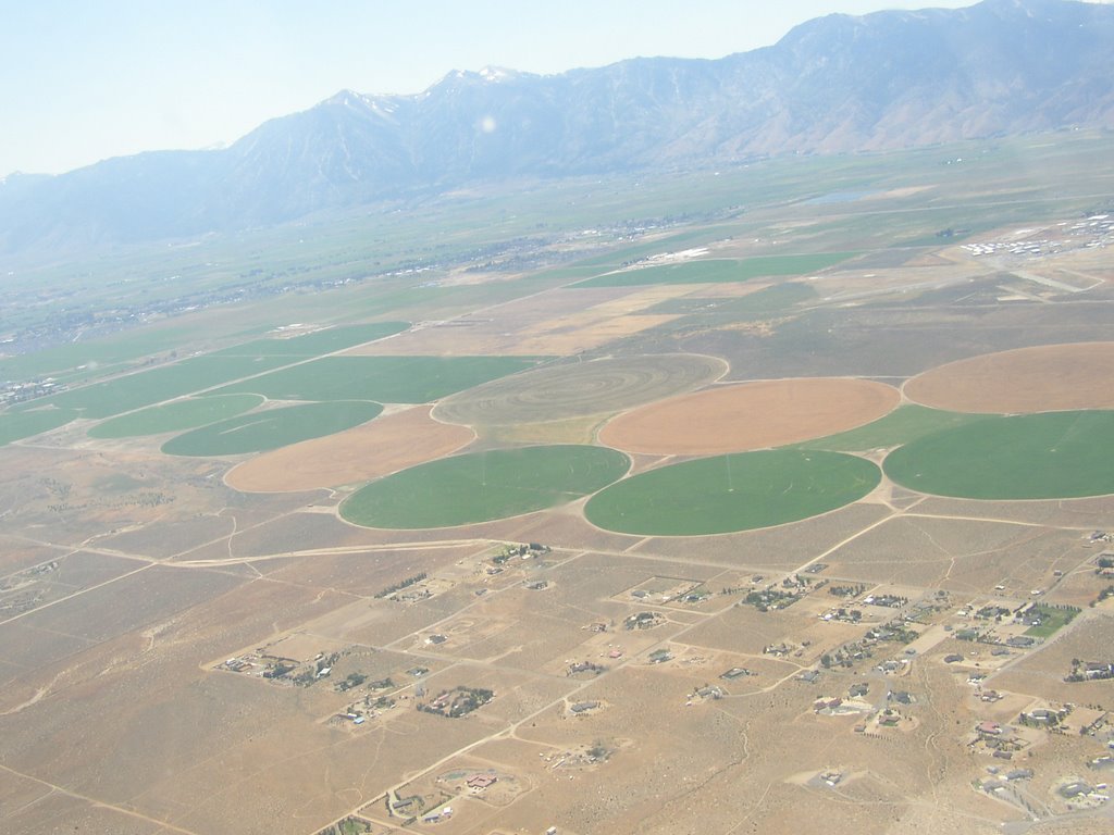 Thermal Hill just north of the airport lived up to its name, taking me back up to 10,200. I tried to head west across the valley toward the Sierras, but the briefings had not been very encouraging about finding lift on that side. I hit sink right away and quickly lost over 1000'. I headed back to Thermal Hill and the Sand Pits and worked back up to about 9000'. At one point I think I found a shear line, which took me up at 4 kts while flying straight ahead! By now it was about an hour and a half of flying, and E had called once, and I was not up to trying to go any distance again. So I just flew around east of the airport, up and down a bit. Lots of minor lift, so I wasn't coming down fast at all. I finally found some mild sink to circle in, over some circular irrigated field, and came down at 1 hour and 58 minutes. I don't think I ever got more that about 7 miles from MEV.
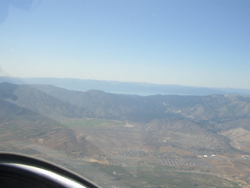
Lake Tahoe visible over the first ridge.
The temporary tower was gone today, so no ATC to deal with. Hard to get a good look at windsocks or wind "T", but it was obvious from my drift and from AWOS that the wind had picked up out of the west. Crosswind landing on runway 30 went well. Long taxi right into the parking area, although as 2 predicted, it gets hard to steer when you get slow and with a crosswind.
New/best experiences:
+ First time at an airport with intersecting runways
+ First time interacting with ATC
+ First use of oxygen
+ Strongest lift I've ever found!
- Strongest sink I've ever found!
+ First use of turn&bank indicator (ball).
So although I never went cross-country, it was still a good experience flying in a new location with very strong conditions.