I let off at 4000' MSL (2500' AGL) in lift, and worked it up to 5500'. I then set out to see if I could work on what I will call the "XC practice triangle". (See "Check Ride and Next Goal".) I got to the north point but found no lift. I set out on the east leg of the triangle but found nothing to sustain me. So I cut back over to that first thermal and worked it back up again.
From there I set out to the southwest point, the town of Winchester. I made it there OK, but again, no lift all the way there. I backtracked to the closest hills and found a decent enough thermal to keep me going, so I set out on the south leg, along the north edge of Diamond Valley Lake. Again, no lift along the course, although some hills by the lake have been rumored to be good sources. So 1/3 of the wayI had to abort the leg and go back to the airport area.
Just north of the airport, with about 200' left before pattern entry altitude, looking for any lift at all, I spotted a hawk below me and off to one side. Sure enough, right over the hawk I found lift! As I went up, I spotted another hawk above me. Like the other thermals, the lift averaged about 2 knots - not all that strong - but I was able to work back up to 4500' or so. Then off to the third point!
The southeast corner of the triangle is the Ramona Bowl, an amphitheater. Again, all the way over there (above part of the town), no lift! The whole flight I was using my PDA GPS to keep an eye on my average glide ratio vs. the glide ratio needed to get back to the airport. Just short of the bowl, the two ratios were about to cross, which meant I was right at the edge of being able to return. With no lift being evident - and having to go back over the exact same route! - I turned back. This time I could not quite reach the hills where the only lift was to be found, so I entered the pattern and landed. If you have Google Earth, you can view my flight in 3-D by following this link.
My total flight time was 1 hour 36 minutes. My goal was to get a 2-hour flights for my Bronze badge, and although I didn't make it this time, this was my longest flight to date. I think I worked about 6 or 7 thermals in all. I took a clue from an article one of our club members wrote recently, and kept returning to known lift sources and then venturing out from there. So although I did not do the legs of the triangle as intended, at least I've been over that terrain and have worked my way further from the airport.
All those weak thermals gave me some time to practice flying the PW5 efficiently, paying attention to the speed-to-fly instruments, practice flying left-handed, practice reading the GPS... lots to do up there!
This was also the first time I took my camera out. Until recently I have not wanted the distraction, and then the last few flights there has been NO time for it - scratching for lift the whole flight. This time, I was in a thermal with one of our club's Blanik so I tried a few shots. That's interesting: flying left-handed, trying to
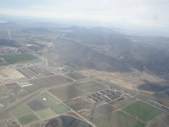 stay in the thermal at a decent attitude, and blindly pointing the camera in the right direction. None of the air-to-air pictures came out. Some ground shots came out OK. Here's one:
I learned one other thing. I did not have the seat back in quite the right position, and after takeoff I discovered I was having to reach just a bit to the stick. After an hour and a half of that, my shoulder was sore. Another item for the preflight checklist!