I spent a week vacationing at Pismo Beach, CA, which did not lend itself to soaring (well, not full-scale anyway). But right next door was the Oceano airport, and there's a fellow there who sells rides in a bright yellow 1943 Stearman biplane. I've never been in a small power plane, so I thought it would be fun... and why just do a scenic flight? So I went for the "thrill ride" aerobatic flight. I've never done any aerobatics, not even spins (I know, I know, I need to do spin training!). But I've never been airsick with steep turns, stalls, etc., so I figured I'd probably do fine with a little aerobatics.
After a quite steep takeoff, and a short flight to gain altitude and waggle our wings at a shiny twin Beech, it was time to crank up to 140 kts and do the aerobatic sequence. First a loop, then a "hammerhead" (technically a chandelle, I think), and a "barrel roll" (technically a snap roll?). The loop was cool - part of the way I looked sideways like I do on looping roller coasters. I was surprised that the G force was not very strong. It felt like less G than some of my early stall pullouts. The hammerhead is definitely a zero-G maneuver: the headset cords were floating up in my face for quite a while. Then the roll, which seemed to have a spiral component, not just a roll around the longitudinal axis. Lots of fun!
Then we flew around a bit and he took it up to about 2300' and did a spin. The tip-over into the spin was a little disconcerting, but then the spin itself was much tamer than I imagined. The world goes around, but not really very fast, so not very disorienting. Two full turns and then we were out of it. So now I'm a little more enthusiastic about doing spin training in gliders - probably next weekend.
We flew around the beach and the sand dunes a while, checking out the ATV riders from about 500' AGL. Then out over the ocean to spot humpback whales! We saw two from maybe a quarter mile away, but each time they stayed down when we got closer, so no really good looks. Maybe they could hear that noisy Stearman coming! Flying along the ocean at 100 kts and 200' AGL was pretty cool, too. I did notice (as I have read before) that the ocean waves give very poor clues as to your altitude. The altimeter said 200' but it looked like we were less than 100' high. Very deceptive - it would make landing on water tricky.
Next week - back to silent flight!
Tuesday, August 23, 2005


Saturday, August 06, 2005
Deciding NOT to fly
Sometimes a pilot needs to know when NOT to fly. Sometimes in a club you spend your time pushing other pilots' planes around and not getting to fly. Today was one of those days.
The weather has been hot and rather humid, with a high pressure system pushing tropical air northwestward and causing thunderstorms. Some days have flyable and some have been blown out. Today was hot (108 in the shade at noon). We could see a storm to the east over Mt. San Jacinto, but it did not seem to be coming our way. Checking the radar map on Wunderground.com from my Blackberry, I saw storms near Palm Springs but nothing near Hemet (more on that later). Others took instructional flights and BFR's in the morning but no lift was happening until after 12:00.
We saw haze patches form up into nice little CU's north of the field, and still no T-storms approaching, so I got my stuff together and we pushed out the Grob 103. A few things started to not feel right:
Other gliders started landing as quickly as they could. I think one glass ship landed crosswise to the runway, which would be into the wind. I think so - I just heard it, didn't see it land... but it either cross-landed or weathercocked very strongly. Everyone tied down quickly and compared notes to see who might still be up... It turned into quite a dust storm, but did not start raining before I left. Pilots on the radio were commenting on the dust obscuring the field and discussing landing other places. Last I heard, AWOS said the wind was 23 kts gusting to 28.
Now I realize that although we have a good view in most directions, the south view is largely blocked by nearby hills. So a T-storm can come from that way and the first warning is the wind.
I checked the Wunderground radar as I drove away, and it still showed nothing in that area. So apparently whatever radar they use has a big blind spot! Now I need to search for another PDA-friendly web site with better radar. 15 miles away, I drove into a torrential rain.
So it turned out that there was only about an hour of good soaring, and I missed it. As I mentioned to a new student, no sense in flying when it's dangerous. Remember, we're doing this for fun, not to prove anything.
Your experiences and comments are invited!
The weather has been hot and rather humid, with a high pressure system pushing tropical air northwestward and causing thunderstorms. Some days have flyable and some have been blown out. Today was hot (108 in the shade at noon). We could see a storm to the east over Mt. San Jacinto, but it did not seem to be coming our way. Checking the radar map on Wunderground.com from my Blackberry, I saw storms near Palm Springs but nothing near Hemet (more on that later). Others took instructional flights and BFR's in the morning but no lift was happening until after 12:00.
We saw haze patches form up into nice little CU's north of the field, and still no T-storms approaching, so I got my stuff together and we pushed out the Grob 103. A few things started to not feel right:
- The wind started to pick up - not too strong, about 10-11 kt, pretty much aligned with the runway, but too steady to be simple thermals going through.
- The AWOS was not much help - many parts were missing or just plain wrong.
- A metal glider came in to land and I could see he was fighting the wind.
- A little power plane took off and his ground speed looked about 25 kt. So obviously the wind was even stronger in the air.
- The little CU's were quickly developing into big CU's.
- We started to see blowing dust from the southeast.
So I was not getting that warm-and-fuzzy feeling. Correction: quite warm, not so fuzzy.
By the time I was ready and the towplane was back from a high tow, it was about 1:30. It all added up to a T-storm approaching from the south, and not a lot of open sky to the north by those local CU's. I had seen this happen before, with an instructor present to help explain all the signs. So although I was on the runway, next to take off, and the towplane was pulling up in front of me, and someone else had just taken off 10 minutes before, I cancelled my flight. I'm glad I did! By the time we had the Grob tied down, the wind was 90 degrees to the runway and dusty. Had I launched any time in the preceding half hour or so, I would have had a bad time landing.Other gliders started landing as quickly as they could. I think one glass ship landed crosswise to the runway, which would be into the wind. I think so - I just heard it, didn't see it land... but it either cross-landed or weathercocked very strongly. Everyone tied down quickly and compared notes to see who might still be up... It turned into quite a dust storm, but did not start raining before I left. Pilots on the radio were commenting on the dust obscuring the field and discussing landing other places. Last I heard, AWOS said the wind was 23 kts gusting to 28.
Now I realize that although we have a good view in most directions, the south view is largely blocked by nearby hills. So a T-storm can come from that way and the first warning is the wind.
I checked the Wunderground radar as I drove away, and it still showed nothing in that area. So apparently whatever radar they use has a big blind spot! Now I need to search for another PDA-friendly web site with better radar. 15 miles away, I drove into a torrential rain.
So it turned out that there was only about an hour of good soaring, and I missed it. As I mentioned to a new student, no sense in flying when it's dangerous. Remember, we're doing this for fun, not to prove anything.
Your experiences and comments are invited!
Friday, July 29, 2005
First remote field checkout
I achieved another goal today: renting and flying a sailplane at a gliderport where I have never flown before. Business took me to Orlando, FL, so I found the closest gliderport and made plans to fly there. Seminole-Lake gp is near Clermont, just 20 miles from where I was staying. They have a Grob 103 and some Blanik L23's. We decided the Grob was the best choice even tho I only had 6 flights in it, one solo.
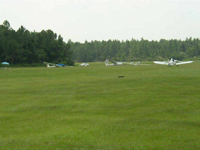
So, this was my first "field checkout". We went over the airspace (they're in Class C and near B), and an aerial photo with their patterns drawn out. Runways are 18 and 36, grass. Due to the choices of emergency fields available, they take off to the north (with up to moderate tailwinds) and land to the south. This is a huge expanse of green grass, mowed pretty short, with a few humps and mild swales.
Their Grob 103 seems to be a later model than ours. I preflighted it mostly by myself and noted the following differences:
* fixed gear
* elevator trim is a tab, not a spring
* stab attachment is different
* control linkages are different, and don't have safety pins
* wing attachments
* harnesses
* canopy locks
* airbrakes don't protrude much when first opened, so their effect is more linear
This was good experience to see how other locations operate. Several differences in field and tow methods.
Since there was no one to run the wing, we did a wing-down takeoff - my first! Very easy, since it's off grass.
It was HOT and HUMID! About 90 degrees and 85% humidity. There was lots of lift, marked by nearly 50% CU cover, but in a narrow altitude band. Cloudbase was about 2500' AGL, and SLGP has a lower thermaling limit of 1200'. Field elevation is 120'. So... Not able to go very high that early in the day (11:00).
We turned a 2000' tow into a 25 minute flight. Lots of narrow thermals. Vultures and other birds helped. I still need some work on coordination and speed control, but after a few minutes I had it working pretty well.
One of my concerns was terrain recognition. That turned out not to be much of a problem. Although it's a sea of green, there are several roads and some distinctive lakes that served as excellent landmarks.
I had a smooth landing, shorter that the instructor would have liked, but nearly in the middle of this 3000' field. Then I found out why he recommended the spot he did: instead of stopping as short as possible, as we do at home, we just closed the brakes and rolled - and rolled - and rolled - what seemed like 200 yards or so back to our starting point. The Grob on short grass feels like it has an engine!
So then he made a couple observations and signed me off. We turned the ship around (you can do that with 1 person on grass) and I took off again. I let off at 1800' in lift, and worked it up to cloudbase at about 2350'. It felt no cooler up there, due to the high dew point and obviously 100% humidity at cloudbase. I was dripping! Then I could not find any other usable lift and at 1200' got ready to land.
My landing was in a better spot this time but I had some excess speed and bounced it a bit. Not bad, but I need to be smoother opening the brakes when floating. I rolled it back to the takeoff point. After pushing the Grob off the field mostly by myself (heavy, but it can be done - on grass), I was done for the day. I was hoping for more than a 17 minute flight, but was too hot to consider flying again.
Monday, July 04, 2005
Flying by the seat of one's pants
I've read about it, I've flown with people who tried to teach it, and I've felt hints of it before. But yesterday in the Grob was the first time I've clearly felt the lift of a thermal more consistently than I could detect it on the variometer. And yesterday's lift wasn't all that great.
The varios in the Grob are not as straightforward to use as the ones in the Blaniks. There are two: one directly connected to the static system, and one electric. The electric one is (at least yesterday) very "nervous", jumping up to 4-6kt for just a half-second, then back down to 1-2kt just as fast. I found it hard to use for centering a thermal. The direct one is less jumpy, but much slower to react. OK for gauging the strength of a thermal over time, or the strength of a shear line. But not useful for finding the center of a small or weak thermal.
Since I'm still getting used to the turn and rudder characteristics of the Grob, I spent a lot of time looking at the horizon, yaw string, and airspeed indicator. Then sometimes I would feel a silent "whoosh" upward, check the vario, and sure enough I was in about 1-2kt lift. Very cool!
The varios in the Grob are not as straightforward to use as the ones in the Blaniks. There are two: one directly connected to the static system, and one electric. The electric one is (at least yesterday) very "nervous", jumping up to 4-6kt for just a half-second, then back down to 1-2kt just as fast. I found it hard to use for centering a thermal. The direct one is less jumpy, but much slower to react. OK for gauging the strength of a thermal over time, or the strength of a shear line. But not useful for finding the center of a small or weak thermal.
Since I'm still getting used to the turn and rudder characteristics of the Grob, I spent a lot of time looking at the horizon, yaw string, and airspeed indicator. Then sometimes I would feel a silent "whoosh" upward, check the vario, and sure enough I was in about 1-2kt lift. Very cool!
Sunday, July 03, 2005
Weather & other prep info
For every soaring day, I prepare by getting as much info as I can about the conditions. Here's what I usually look at:
- The day before, I usually look at Weather Underground at http://www.wunderground.com/. It includes a forecast of temps and winds by hour for the next day.
- Local soaring forecast at http://www.wrh.noaa.gov/sgx/data/aviation/soar.htm. I print this and take it to the field to share.
- General pressure patterns at http://www.hpc.ncep.noaa.gov/basicwx/basicwx.shtml. I look at several times to get an idea of the direction that highs and lows are going. I'm sure there's a nice moving map somewhere - if anyone knows a good one, please comment.
- DUATS at http://www.duats.com/ to get terminal forecasts for the two biggest fields closest to my home field.
- Wind forecast using the Old Flight Path Tool at http://adds.aviationweather.gov/java/. I look at about 2000' MSL (as close as I can get to my field altitude) and about 5000' MSL (close to release altitude). I print this. I haven't tried the new tool yet.
- Lately I've started to use the forecast soundings chart at http://www.emc.ncep.noaa.gov/mmb/soundings.nam/snding_off.html to get an idea of possible inversions and the dew point spread. Unfortunately the closest one is for Miramar NAS, so I'm not sure how accurate it is for my home field. I print this.
For non-weather stuff:
- AOPA's Temporary Flight Restrictions and NOTAM page at http://www.aopa.org/whatsnew/notams.html
- DUATS for NOTAMs that might affect the area I expect to fly.
I'm now starting to save the things I print, and make some notes on them at the end of the day. I'm hoping to review them over time and see which products are the best predictors.
Subscribe to:
Posts (Atom)