Saturday, December 03, 2011

Winds of Change at Hemet-Ryan

The gliders have returned to Hemet! I've been too busy to blog lately, so I'll catch up now. Orange County Soaring and Cypress Soaring have begun joint operations. This was our third week of aerotowing, and my second week of flying. A couple weeks ago there was not much lift, and I only got a 23-minute flight in some convergence.

This week the weather was... interesting. The forecasts disagreed as to whether there would be thermal lift and how high it would go. We're experiencing a "cold Santa Ana" condition, in which high pressure in the deserts causes high winds in the basins and valleys. Such winds usually bypass the Hemet valley, but if they do hit it they can tear apart all the thermals, and usually don't cause much usable wave. (At least that's how it seemed to me... two years ago at Hemet I had no real wave experience, so maybe I just didn't know how to recognize and exploit it.) As the air comes through the Cajon pass it is compressed and warms up, but it was obvious that it was not dry as it often is. As I was driving to the airport, I could see the air downwind from the pass condensing into turbulent clouds, which got bigger and bigger as they went south. Most of the clouds hugged the Mt. San Jacinto area, though, and the Hemet valley was mostly clear. The clouds that did appear in the valley looked like rotor, so maybe the wave would work?

Some of the Cypress guys got to flying earlier than we did, and got to over 10,000 feet over the lake! They seemed to think it was thermal lift.

I took off in the PW5 about 1:00 and found some workable lift right away. It was turbulent but broad, big enough to circle in, but not terribly strong. The highest lift I saw on the ship's digital display was 3.2 knots, but the vario was not working right and I think it was quite a bit stronger. My clip-on electronic vario was often going crazy, so I think the lift may have been in the 6-8 knot range at times. But it didn't go very high: my max altitude was 5200' MSL.

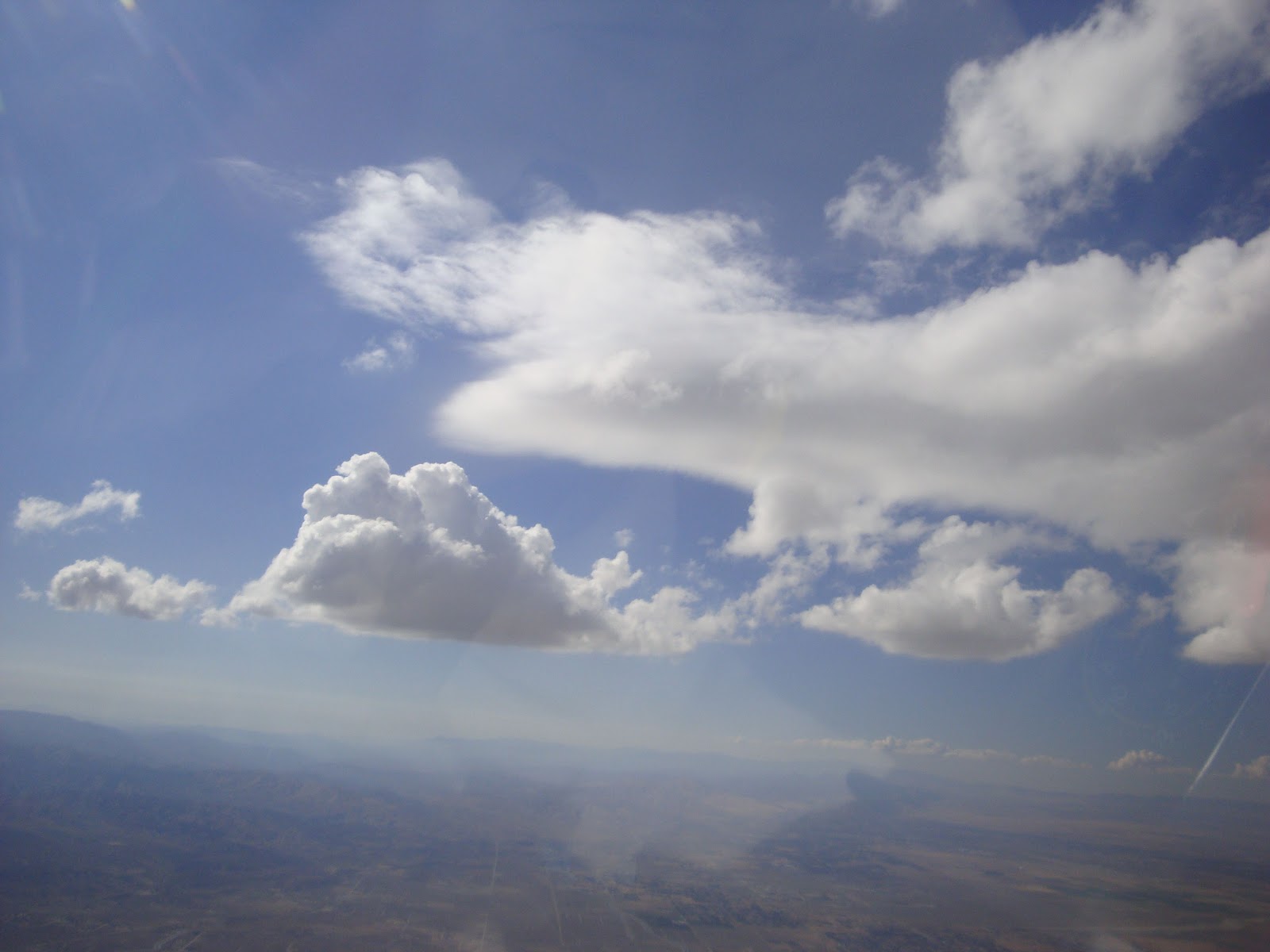
T and M in the club's Grob 103 and I thermalled together for a while, and I took a few pictures. The Cypress PW6 also thermalled with me, but they were higher and I couldn't get any pictures.


The lift was never smooth, so I never encountered wave action. It seemed to be all thermal, which was surprising with the strong wind. But the temperature differential was substantial, so I guess it was strong enough to punch up through the wind. At one point I was about 3,000 to 3,500 MSL, and the outside air temp was 18 degrees lower than the AWOS was reporting at 1,500 MSL. I came back after an hour so G could have the glider. The lift was still working - I just sped up to create extra drag.


Sunday, November 27, 2011

Historical Trends in Sailplane Activity at Hemet-Ryan Airport

In support of our negotiations with the County of Riverside regarding soaring at Hemet-Ryan Airport, I have conducted a study of the number of sailplanes based there from 1996 through 2009. The source of data for the study was historical images from Google Earth: I counted the gliders, hangars, and trailers in each image and did some analysis and graphs. The study is available here.

Sunday, November 06, 2011

Dual Flight over Early Snow


Friday brought a fast-moving cold storm to Southern California. Saturday looked to be clear skies and cool aloft with possible thermals to 9 or 10,000 feet, but also possibly windy to 15 knots, with the wind maybe too westerly to make good wave. As I was driving to the airport another pilot called and we talked about sharing a flight, so I prepped our Grob 103. It's the better ship to be in if the winds get strong, but its oxygen tank is out for repair, so I knew we couldn't go too high if the wave was working. We needed to do several items of maintenance, but that gave us some time to get early flight reports from a couple of other pilots. It sounded like a high tow over the mountains might be the only way to fly today, so I was glad to be splitting the tow fee.


There were lenticular clouds to the north, but way too far away to be useful... that's common at Crystal.


The wind was from the west but not very strong, 5 knots most of the time. There was obviously a gentle south wind coming over the mountains, pushing clouds over the rim into the desert as you can see in the picture. And we were told there was an east wind aloft, so ridge lift on the east side of Mt. Lewis was a possibility. And with the clear air, thermals might pop too. So... the air was in a lot of motion today - what would we find?

I took the rear seat, and G as PIC took the front. He said he had not had much experience with wave or ridge soaring, so he thought maybe I'd do much of the flying and he'd to the takeoff and landing. Fine with me. I took myPDA/GPS device hoping to get a trace of our flight. As we were pushing out to the runway, a cigar-shaped lenticular cloud formed right between us and the mountain, so smooth wave was happening. But by the time we took off, it was gone.


Another pilot reported that the rumored ridge lift on Mt. Lewis was not working, and the spillover clouds were really getting thick, so we let off at 8500' kind of in front of the mountain and went looking for ridge lift in various places. G didn't find anything so after a while he turned it over to me. I had seen some raggedy little clouds in a rough SW-NE line that I thought might be weak rotor clouds, but there was no real lift next to them.

So on the theory that the west wind might be making ridge lift or weak wave, I tried a north-south line over the low end of the Second Ridge. I did find some narrow lift and was able to work up in it through several back-and-forth passes. I tried to keep my lines tight in case it was a narrow band, and that seemed to work. The picture (click to expand) shows a trace of that portion of the flight. It was not smooth enough to be wave, and there was no obvious north-south ridge to be making orographic lift, so what was it? I thought maybe the nose of the Second Ridge was creating what they call "bow wave", but the wind wasn't really strong enough for that. It didn't last long, but I gained 1,000', so we had time to fly around.

Didn't find much after that, and eventually got low enough over the ridges that I decided to head toward a weak little lenticular could that was perched over the airport. I found neither good lift nor good sink on the way, and by the time we got there the lennie had disappeared. I gave the plane back to G and he went in search of thermal lift on the way back to the landing pattern. There may have been a little, but it was pretty weak and not working.

There were a few other odd little lennies to the west, but too far for us to reach. We came in for a landing after 51 minutes. The surface wind was still from the west and only about 5 knots, so it had never really picked up.

We had seen a glider above us and later below us when we were working the one area of mysterious lift. Back on the ground, instructor D asked, if that was us he saw, and commented that the shear line had been good but had disappeared as we worked it. Then the light went on! The wind from the south over the mountain, and the wind from the west, were colliding and going up. It wasn't ridge, or wave, or "bow wave", or thermal - it was convergence! I'm gonna need a checklist just for all the different kinds of lift we find in the chaotic environment over the mountains!

Wednesday, October 26, 2011

Hemet-Ryan Master Plan Includes Soaring - NOT!


The County of Riverside published their new Master Plan, along with an "Initial Study" that addresses environmental and other issues. The Plan is full of unsubstantiated assumptions, unsupported conclusions, and undisclosed motivations. It assumes soaring will come back but will fail... it states that the Cal Fire operation will move and obliterate the soaring space but admits this will not help Cal Fire... it states this is necessary to provide "opportunities for new aviation uses on the south side" but doesn't say what those might be, and it admits that growth at HMT will be minimal.


In other words, it's a sham. FAA forced them to update their plan, and they did so with no input from soaring. Although they state that HMT is primarily a recreational airport, they plan to shut out a segment of aviation that accounts for a large fraction of the recreational operations. FAA ruled their actions illegal... but they persist in being uncooperative.

Here are links to the Plan and the Study.

If you'd like to write to the County about this issue, you can find the address and a sample letter on the Save Soaring at Hemet Today site.

Wednesday, October 05, 2011

It's Complicated

The wind was from the south and there was enough moisture in the air that cumulus was a possibility, with cloudbase at 10,000 to maybe 13,000 feet, but little chance of overdevelopment into thunderstorms. One of the very experienced instructors came back from an early flight, so we asked him what it was like up there. He said, "Confusing, but there's lift everywhere." Now, if THIS guy thinks it's confusing, you know it'll be a challenge for low-time pilots like me.

The soaring textbooks show simple, idealized diagrams of thermals, ridge (orographic) lift, and wave lift. In the real world, It's Complicated. Those types of airflows intersect, interact, and interfere with each other.  Figuring out exactly what's going on can be, as he said, Confusing. Why worry about what kind of lift it is, why not just fly in it? Well, in thermal, you typically circle. In ridge, you go back and forth following the contour of the ridge, in the "sweet spot" above and maybe a little downwind from it. In wave, you go back and forth in a (possibly long) vertical zone, or sometimes fly directly into the wind. So... if you guess wrong about the type of lift you're in, you're likely to fly in the wrong direction, and right out of the lift.

From the ground, I saw the mountain peaks (9,000 and 10,000 feet tall) creating an expanding trail of cumulus clouds. But the clouds didn't start above the peaks, they started downwind of the peaks, and at about the same level. So they did not act like classic orographic CU. This picture kind of shows it but not too clearly - the clouds spawned from the left and grew larger to the right, out of the frame:


Here's a sketch of how it would have looked from the side:


And from above:


Once in the air, I found lift under each of these "wakes" of clouds. What kind of lift? It was wide enough to circle in, like thermal, and strong: I gained 5,000' in no time. But it was windy, which usually tears apart thermals. It was downwind of the peaks, like wave... but it was not smooth, and the clouds were puffy like CU, not smooth lenticulars. And it was downwind of the peaks, not starting over it as ridge lift would be. So... it was something else. I came to think of it as "wake" lift, triggered by the peaks like wave, going down and then up like wave, but turbulent enough to make puffy CU instead of smooth lennies. And in front of the leading point of each "wake", there were clouds that were NOT rising and puffy, but rather ragged and rotating: rotor cloud as you would see below a wave:


Imagine three rocks in a stream. They make V-shaped wakes which go up and then down and then up, and get turbulent downstream. And if the rocks are close enough, the wakes start interacting. Remember "constructive interference" from physics? The wakes can constructively interfere and the lift can add up to be stronger and higher than the wakes. And that is just what I found. Where the V-shaped cloud streets started to come together, I saw a small, smooth lennie! Right in the middle of this picture, you can see the smooth, rounded, fuzzy leading edge of it. The CU in the lower left is in one of the wakes, and there were other CU's directly behind me. 


The lennies were wedged between the wakes as shown in the next sketch. The wakes eventually merged into a solid mass of CU.


I got up to cloudbase under a wake, then left the wake and approached the leading edge of the lennie, hoping to find smooth wave lift, and I did. (That's the first time I have actually been close enough to approach a wave cloud and find the lift. Up to now, my experience with wave lift has been in clear air.) The wave lift was pretty narrow, and I could not move very far without getting out of it, but it did take me up above the CU cloudbase, which is pretty rare. In this next pic, you can see the edge of the lennie again, and look downward at the base of the CU:


I went as high as possible under the leading point of a wake, and then tried to hop to the peak that was triggering it, but that was directly upwind. The cloudbase was about 2,500 feet higher than the peak, but since I had to fly upwind that was barely enough to get to the peak with a safe margin of altitude. I was able to overfly Mt. Baden-Powell, but not Mt. Baldy.

Confusing and complicated - but enlightening! I did not go far, I went all around the airport trying to visualize what the air was doing, trying out and verifying theories. Sure enough, there was lift everywhere, and the corresponding sink was not very strong. I easily stayed up for two and a half hours. Unfortunately my flight recorder malfunctioned so I don't have a flight trace, but I did get some pretty good pictures of these interesting situations.